
Party: Felix Ossig-Bonanno
Solo Walk(/scramble/climb)… ~13.5hrs, ~41miles (~66km)
After a rest day it was time to get out again. The next trip I had in mind was to go up the valley I had come down, explore the upper section of the valley I missed and then take the track past Black Lake (glimpsed from the top of Wolverine) and through the Ballfield.
As I was moving further south it made sense to access this from a different trail head. I figured this also meant I could cycle further and save some time. I ended up cycling through the South Bivouac TH and taking the Spencer Loop. I didn’t complete the loop instead walking my bike through to the Wolverine Bowl Trail. This probably wasn’t the most efficient route, but I did get a pretty good photo of a bull moose. This is the closest I have been to a moose, this guy didn’t seem too bothered by me.
I warned some people about the moose… it turns out they were flying out and hadn’t yet seen one so I told them where I had seen it and turning right continued in the wrong direction. I cycled up the Golden Grass trail and then the South Fork Rim before accepting that it wasn’t turning around and headed back. The down hill single track was exhilarating and I could see why people got into mountain biking. It was super fun dodging the plants on either side of the track!
I met the people I had talked to on the bridge – they hadn’t found the moose. They headed off for another attempt and I quickly decided to go with them to make sure they weren’t looking in the wrong place. The moose had moved and was no where to be found.
 |
| “Curious Moose – You’re not in danger yet!” “A word to the Wise… a half-ton moose with four slashing hooves could stomp the living daylights out of you”! |
I continued up to the Middle Fork trail and soon decided to leave the bike a little earlier than intended as I seemed to be walking it a lot anyway. I chained it to a tree and continued across the next bridge and then took the track up into the Middle Fork listening to a podcast interviewing Josiah Zayner on his recent experimentation with microbiome transplantation (Verge article).
I passed another group looking at a distant moose on the hill and soon reached the track up to Black Lake. I continued along a track I hadn’t seen on maps up into the intriguing head of the valley I had seen dropping down from Williwaw Lakes a couple of days ago.
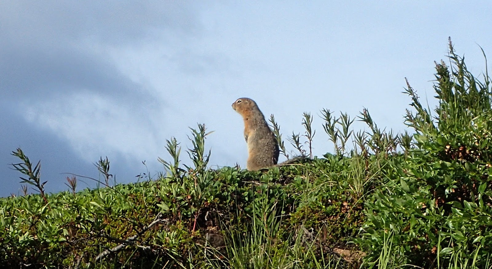
Crossing a rock field I finally managed to get a photo of one of the arctic ground squirrels (still not confirmed) that I had been seeing and hearing.
 |
| Finally got a photo of one of these elusive critters |
I passed a lady and her young dog with sharp teeth. I also found he had caught one of the squirrels but she couldn’t confirm what the name for them was.
The temperature began to drop, the sky darkened and a wind began to blow. I had my hard shell but realised I forgot to put my beanie back in and also didn’t have any other layers. It started to rain lightly and I hoped it wouldn’t get any worse. Continuing on I also realised I hadn’t brought enough food. Oh well.
The track soon petered out and I continued along crossing a number of small streams coming from the slopes above. A couple had wild flowers all around and there was moss everywhere. In places the water would disappear beneath the moss. It was very nice!
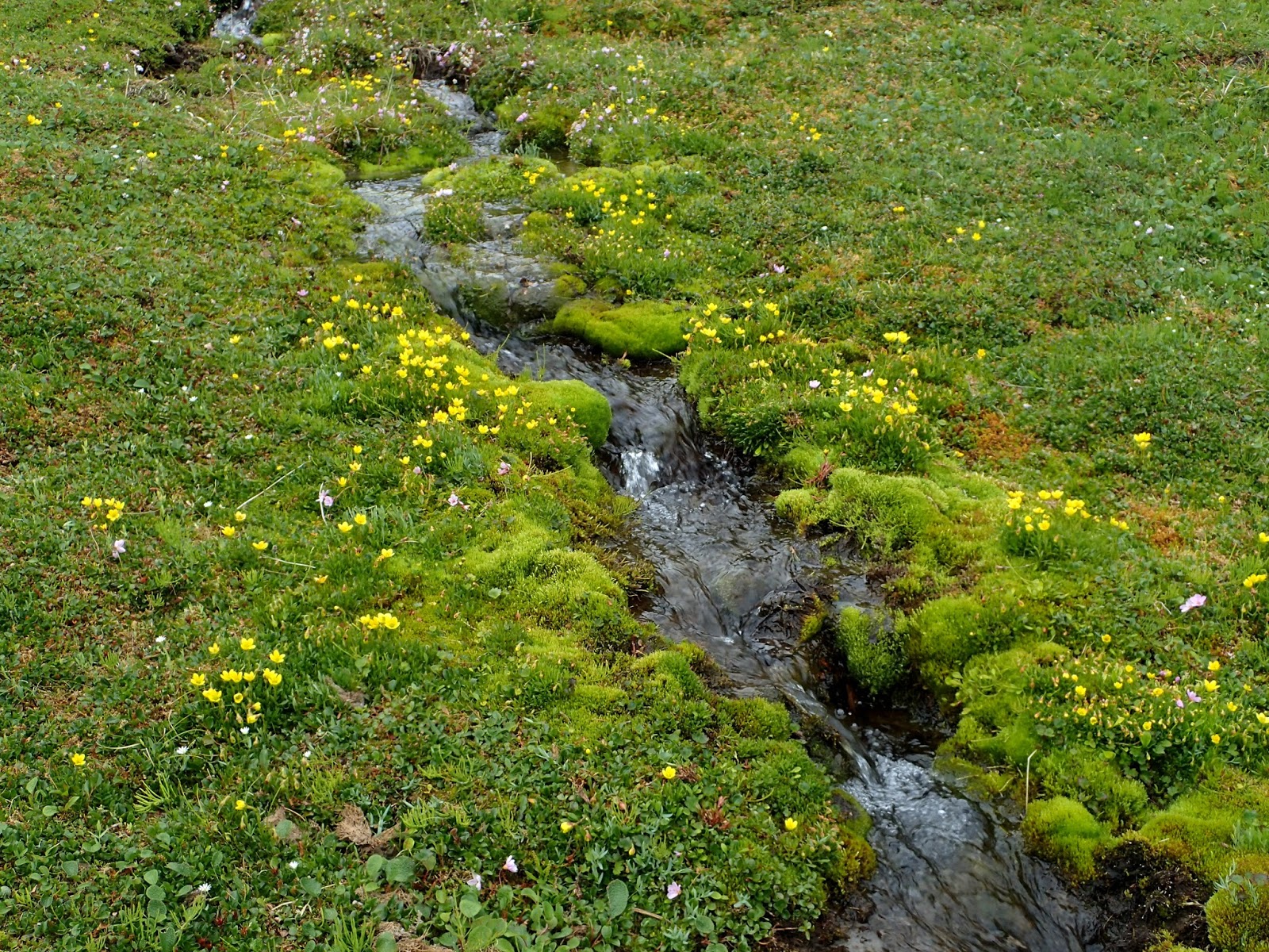 |
| Beautiful mossy streams including sections of moss bridges! |
There was a small lake at the back of the valley but it wasn’t as picturesque as some of the other spots I had visited.
 |
| Colourful flowers |
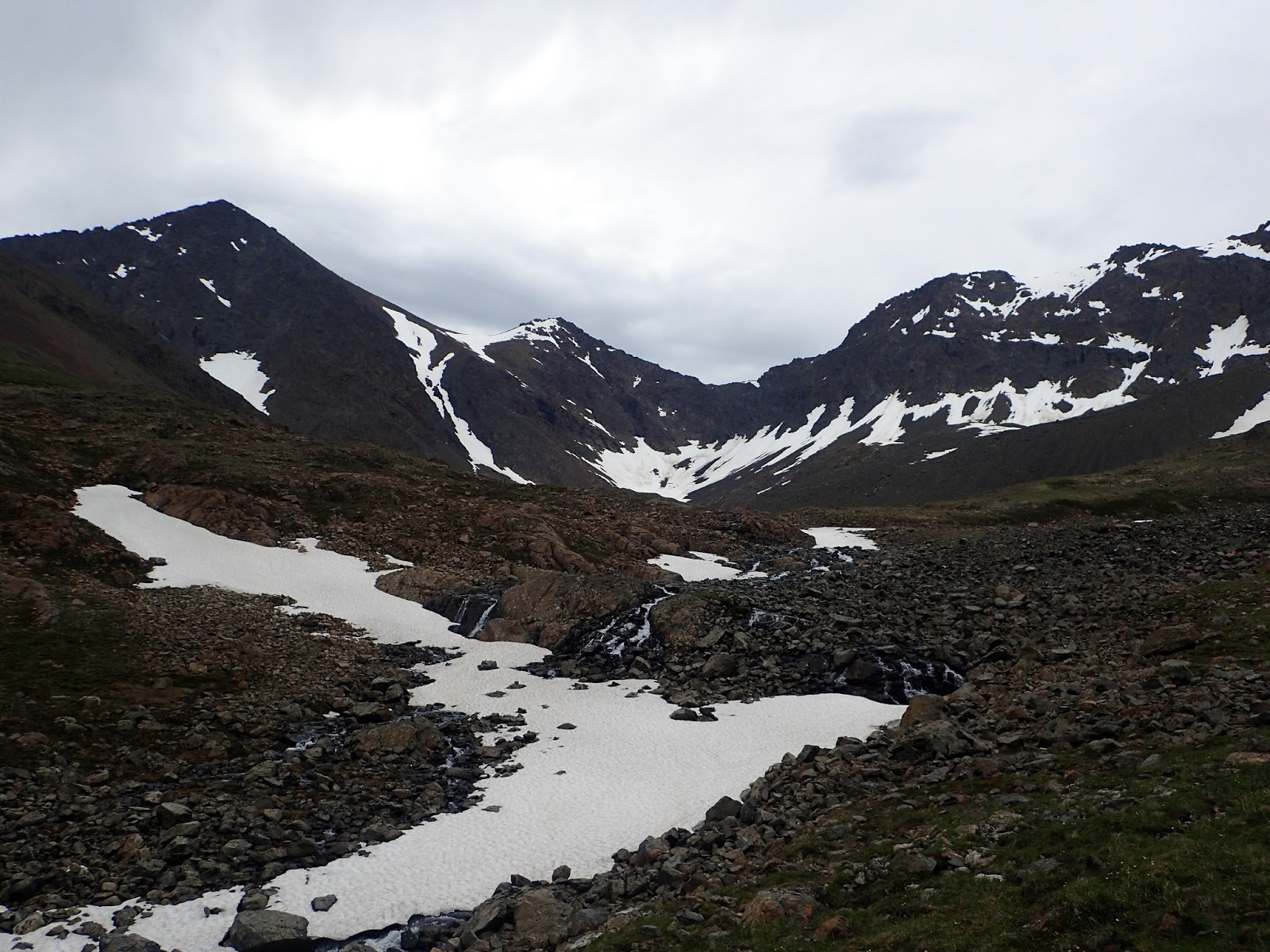
Heading back I looked up at the ridge on my left… if I could climb up there I might be able to traverse to O’Malley Peak! It all seamed very exciting, so inspecting the ridge I decided the obvious weakness was the natural ramp heading up to the right.
As I got closer, traversing the loose scree slopes I decided that climbing looked fun, and although not overly sensible, this is what I proceeded to do. At first it was easy scrambling, but then it got trickier, and sometimes a route would dead-end forcing me to down-climb which is always much more tricky.
 |
| The route I attempted pretty much went up the extreme left of this photo |
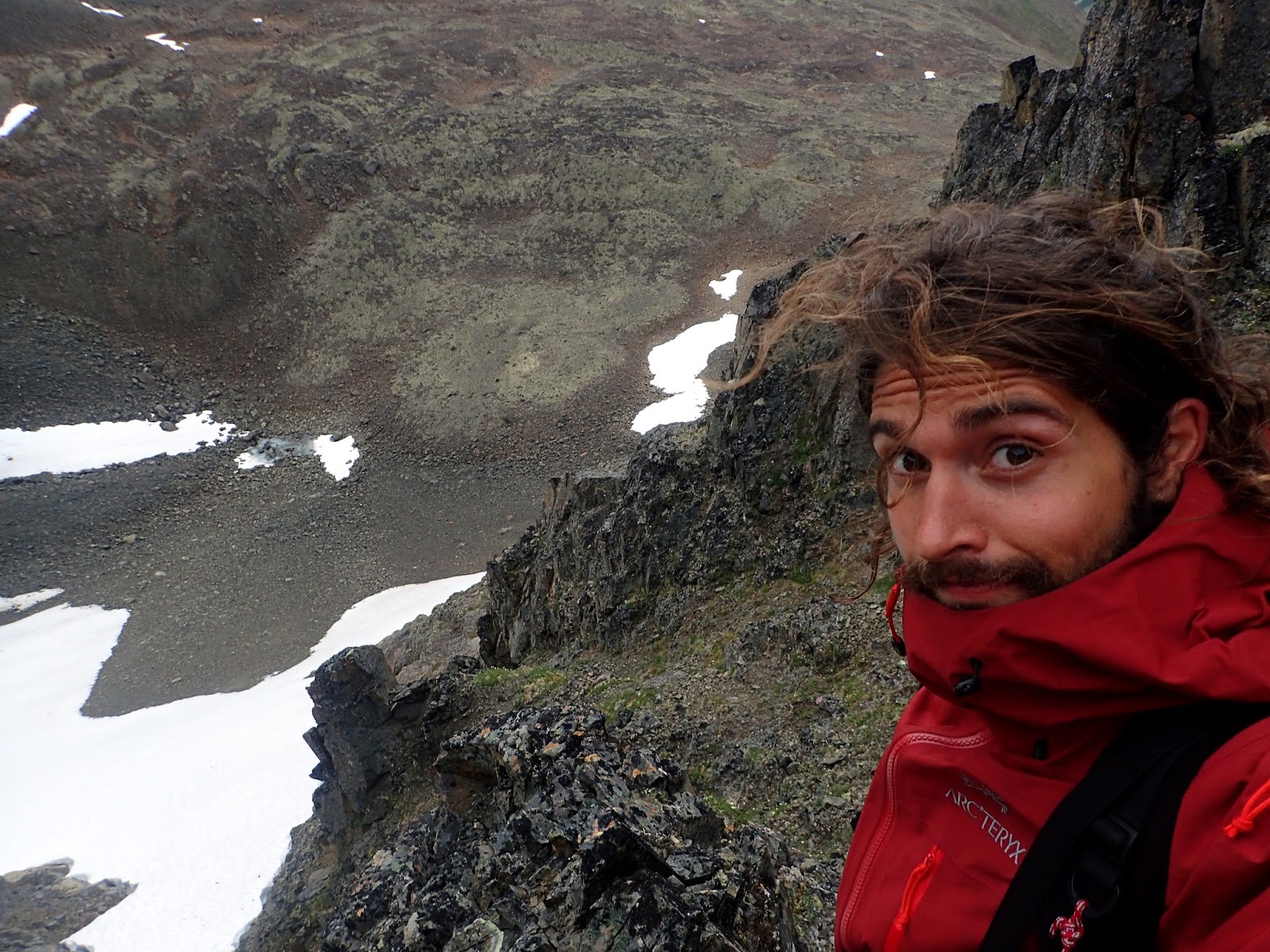
As I climber higher I became more and more invested in the climb and began to actually climb – everything easy (grade 8-9) but a fall wouldn’t end well. It wasn’t tricky but mentally taxing as you had to watch out for the slippery rocks (moss and a bit of rain), loose rocks, and hazardous scree slopes. To calm myself I said to myself “remember to smell the flowers” and would turn around for a breather and enjoy the view.
 |
| Getting cold – see ice on head Also getting worried about the climb i’m attempting… “remember to smell the flowers” |
I was glad to reach the top, but looking up at the peak above me (I had to veer to the right) I decided it would be silly to free climb higher… I wasn’t prepared to climb back down the way I had come unless there wasn’t another option so I followed the ridge down utilising goat/sheep? tracks (I still hadn’t seen any though!) until I found I spot I thought should be possible to climb down.
The rocks I sent crashing into the snow below were good incentive not to fall.
 |
| Decided to bail… |
 |
| Down there! I guess I have no choice… |
Climbing down the snow I slipped but managed to quickly stop myself from falling using the two large rocks I had found and was using as makeshift ice axes.
I was glad to reach the bottom.
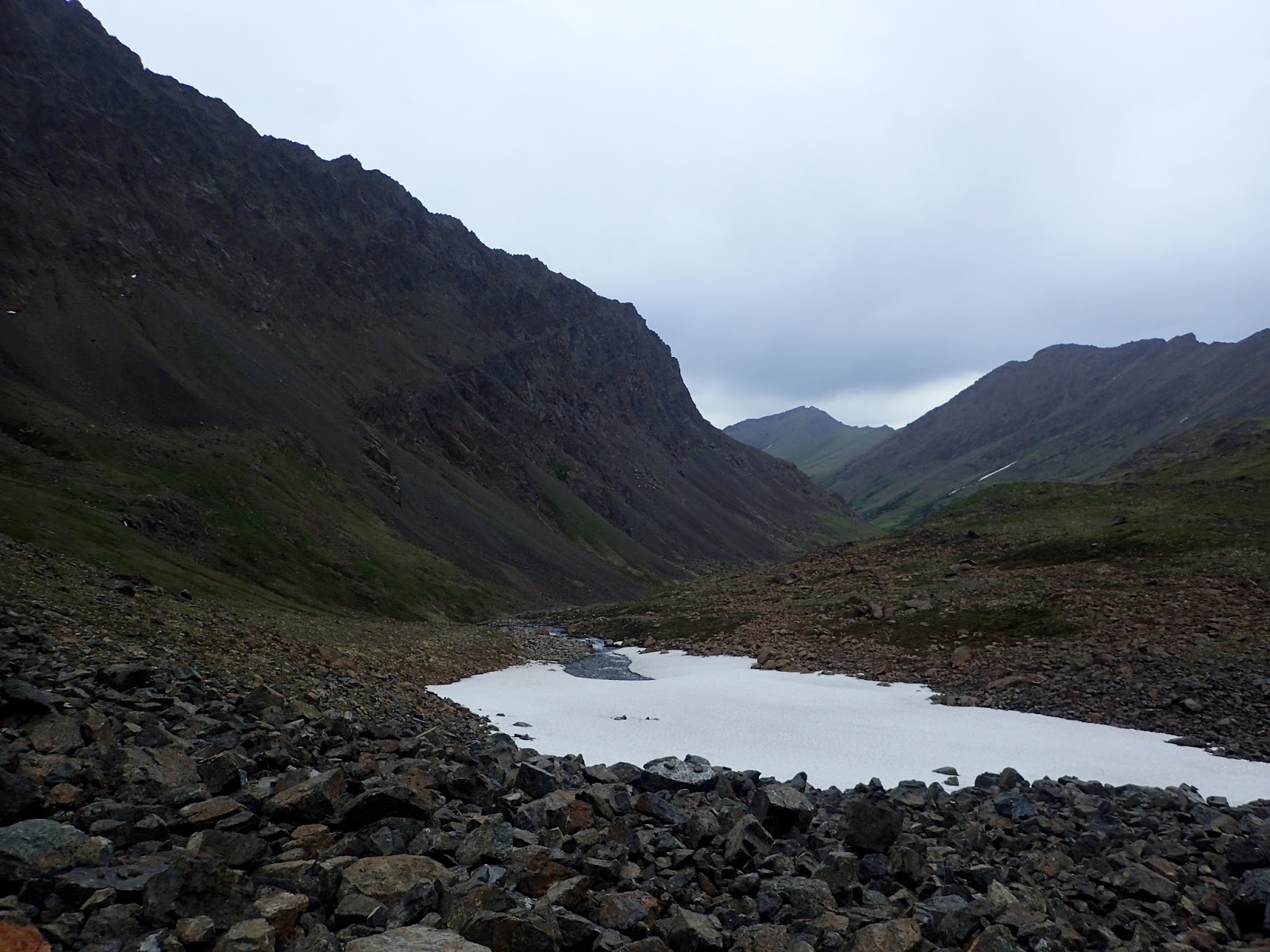
 |
| I reached about that point (just before the steep step) before turning back. This is looking at the ridge from the opposite side to which I climbed – I dropped down this side. |
It was then and easy walk across rocky flats until I was looking down on Black Lake, though it looked blue to me! I started climbing down a scree slope to my left, but spotted and easier route to the right and climbed back up to descend that way; trampling the flowers as I went – sorry!
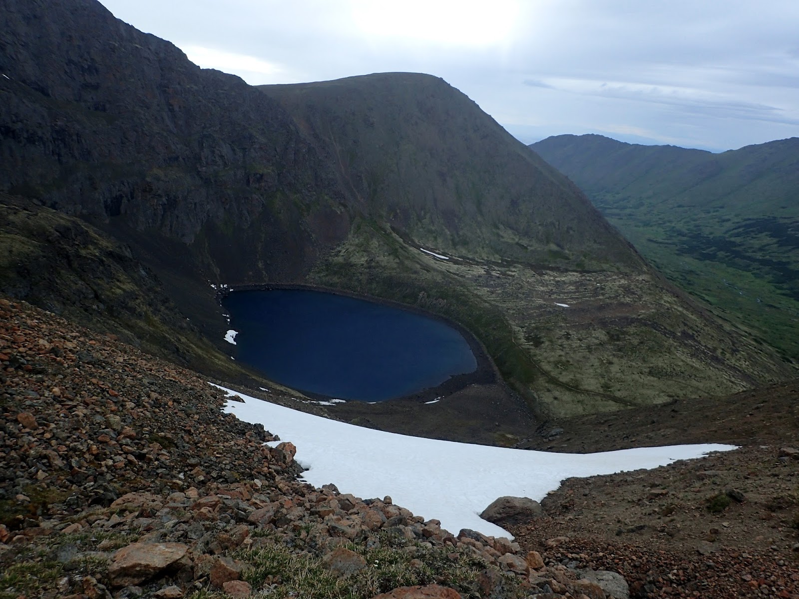 |
| Black Lake – looking more blueish to me? You can see the Football Field track passing the lake and heading up in the centre of the photo |
 |
| Amazing flowers – sorry for trampling on you! |
The way up the other side was far less steep than the slopes I had been on for the last few hours and was also tracked meaning I could relax a bit and not concentrate on footing so much.
At the top I past Deep Lake – which was quite inset, and proceeded to cross the Football field.
I started seeing more of the arctic ground squirrels and stopped for a while to see how they would react to my continued presence. I also started to talk to them trying to imitate them in their language. It popped its head out a few times from different sides allowing me to get a few photos. It then ran out shooting across the rocks.
 |
| Stalked this guy for a bit. Found out that if I try and talk to them they tend to trust you more. |

I started talking to the next one I saw and it seemed much more relaxed and got some nice photos:
 |
| Another one. |


I could soon look down into the South Fork, Flattop and the Powerline Trail clearly visible below. Instead of heading down the main track which headed down in a gully, I followed the ridge offering amazing views of Anchorage.
 |
| Looking over at Flattop. Will get up there some time I presume. |
The track started to fade, but I was adamant to continue as it would cut a bit of distance off – and I also didn’t feel like backtracking.
Walking up the Middle Fork I had noticed that the cones(?) on the spruce seemed much more purple than I recalled. I was dropping back into the vegetation again and the colours again caught my attention and this time I thought I should grab a photo.
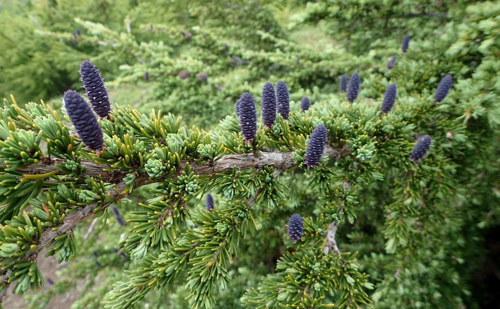 |
| The spruce cones(?) are starting to change colour – this was the first day I had noticed purple colouring. |
I was soon bushbashing/bushwhacking through clouds of small yellow insects, they got everywhere! I didn’t stop to get one out of my eye as I needed to get away from them first! (many to wash out of my hair when I got back!)
I found the main track and got a closer view of the moose I had seen whilst walking down. I continued along the track. Just before reaching my bike, I met a guy from Slovenia who was visiting for a while after the bear conference. His phone had died and he was in a bit of a panic as he couldn’t remember if his girlfriend was flying in today or tomorrow… he would be in trouble if it was today! I let him use my phone and got some snacks to nibble on while I was waiting.
I was soon cycling along and pretty keen to get back – I was starving!
From the Prospect Heights TH I took the Upper Gas Line trail then the South Bivouac back to familiar territory. It was late when I got back – I couldn’t believe how long the trip had taken, I was also very surprised by the distance I had covered when I actually looked it up…
I think I think I am underestimating trips because the map grid is in miles…