Party: David & Nicole Lee (+1 in utero), Tim Vollmer (T2), Tom Murtagh, Yumi Hong, Tony Ruzek
Yes, yes, I know this was a while ago, but I promised at the time to write the trip report, so here it is. Hope you are happy. If I have misremembered anything, I take no responsibility.
Mount Kaputar is an extinct volcano, and the area surrounding it is full of basalt plugs, lava terraces and volcanic dykes, making for a very different landscape to our usual haunts in the Blue Mountains. The plan was to do an exploratory 3 day trip in the Mt Kaputar National Park. None of us had visited the park, and there was no record of a club trip having been in the area, so it was very much an exploratory trip. Much time was spent examining maps and deciding on possible routes, most of which were discarded as soon as we got there and saw the terrain.
We left Sydney Friday just after lunch to begin the long drive to Kaputar. We made it to Narrabri for dinner, only to realise that it was a public holiday, and almost everything in the country town was closed. Luckily, we found a nice steakhouse in which to fill our bellies and further plan our walk. Unluckily, the only petrol station in the town that sold LPG for T2’s car was closed leaving hm with a rather empty tank. The decision was made to press on regardless in true SUBW fashion, and so we drove to the Mt Yulludunida car park and set up camp, some just sleeping in the picnic shelter.
Day 1
Saturday morning had us all awake and ready to go. We left T2’s car at the bottom, and all piled in to one car for the trip up the mountain. The decision was made at this point to do a quick side trip without packs to attempt to climb Euglah Rock, as it looked like an interesting feature on the map and was relatively easy to get to. A short fire trail and scrub bash got us to the base of the cliff, and we ended up doing a full circuit before giving up. there were a few possibilities, but nothing we were willing to climb without at least a hand line. We returned to the car with a few stops for photos, and drove the short distance to the start of the REAL walk at Coryah Gap.


After rearranging packs and filling up on water (we had no idea as to the availability of water on this trip) we started off along the well-made track to Mount Coryah. This is a very pleasant walk that does a loop around and over the cliffs of Mt Coryah, and is well worth it for an easy day trip if you are in the area. we followed the track along the base of the southern cliffs, and then up the metal stairs to the top of Mt Coryah, where we stopped for elevenses and to admire the view.
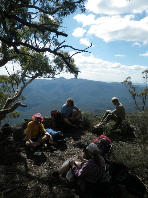
From here we left the track, following the top of the cliffs south towards Mt Mitchell. The walking was easy through pleasant open forest, with occasional patches of open rock and grass, possibly relics from when the area was used for grazing in the early 1900’s. It made for fast walking, and we reached Mt Mitchell in no time, pressing on down the southern slopes in search of a good lunch spot.

We encountered our first scrub of the trip at the base of Mt Mitchell, and spent a short time bashing through it, before finally breaking out onto the Lava Terrace that was our goal for the day. This Terrace stretches for 3 Km to the south, narrowing down into a broken ridge line, and we were hoping that it would be easy going. It exceeded all our expectations!

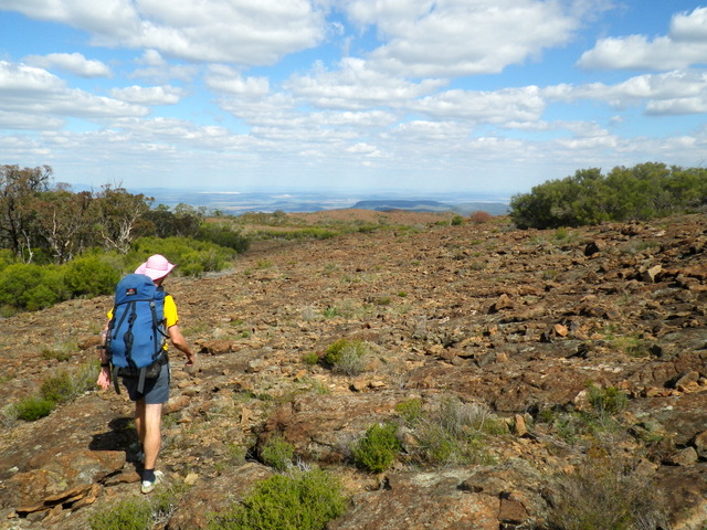
The surface of the lava flow was quite rough with lots of broken rock but only minimal scrub, and the views were spectacular. We traversed this alien landscape for a Km or so, before stopping for lunch with views to the Camel’s Hump; an interesting formation caused by a fold in the lava terrace. After a quick bite we left our packs and headed into the scrub to find a route up. It was here we came across our first water source: a small creek with plenty of running water, cutting through the terrace between the Camel’s Hump and the main plateau. I am not sure how reliable this water flow is, but it was certainly welcome, and we all filled up on clean fresh water.
The climb up the Hump was quite easy, with only a little exposed scrambling, so it wasn’t long before we were all admiring the view from the top.

We cut back down through the scrub to our packs and continued along the terrace, looking for a good spot to set up camp. We came across evidence of feral goats, and it wasn’t long before we saw some live ones, including one who seemed to be running in circles deliriously. Maybe he was sick or possibly poisoned? We soon found a spot on the western edge of the terrace with plenty of space for tents, and dropped our pack to explore.

We continued south along the terrace, where the lava flow had begun to fold and buckle, making for some interesting scrambles. The plateau became quite narrow towards the end before finally dropping steeply to the ridge line. It looked possible to find a way down, but we decided to leave that for another trip, and returned to our camp.


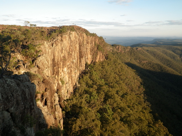
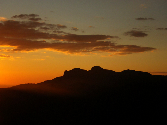
T2 and I decided to check out a nearby crevasse for water while the others set up camp. We didn’t find much more than a few puddles, but were rewarded with spectacular views along the edge of the terrace in the fading light. We returned to camp empty handed, and all gathered to enjoy the sunset before dinner and an early night.

Day 2

Day 2 dawned warm and clear, and we made plans for the days walking over a leisurely breakfast. Our original plan of dropping off the end of the terrace and crossing the valley below was happily abandoned in favor of staying high and investigating the large volcanic dyke we had passed the day before. We packed up and headed back north along the western edge of the terrace, making a quick side trip to fill up on water at the creek we had found the day before. This turned out to be unnecessary, as we crossed another flowing creek after scrambling down the sloped side of the terrace towards the dyke.
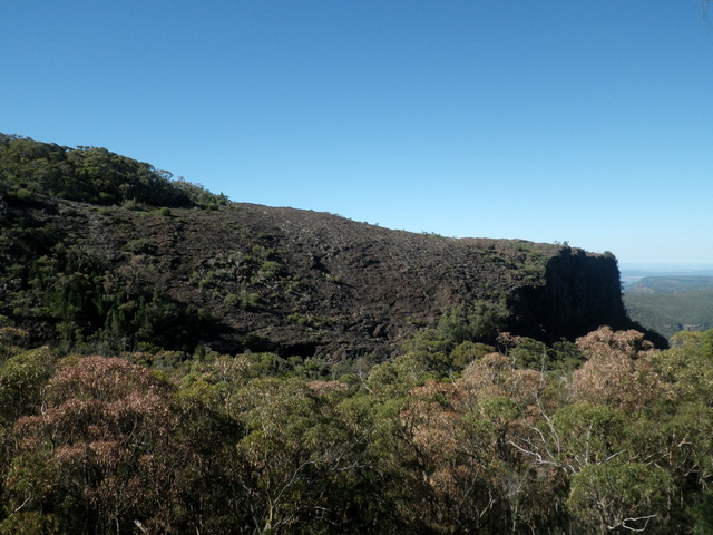
From here it was a steep climb up to the base of the dyke where we spent quite a while searching for a way to the top. The lava here had formed interesting patterns, almost looking like dragon scales, and made for easy climbing. It wasn’t long before we were enjoying elevenses at the top with fantastic views back over the lava terrace and Camel’s Hump, and forwards to Yulludunida crater, our target for day 3.

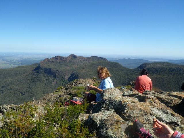
From here, it was time to drop down to get across Eulah creek. We decided to try and follow the top of the dyke as far as possible, and were rewarded with a spectacular scramble down the ridge line, which eventually devolved into thick scrub and loose rock. We bashed on down to Eulah creek, where we were greeted with a small flow of algae filled water, dashing our hopes of a lunchtime swim (for now…).


Lunch was had at the junction with a small side creek that we would be following up to get back on to the ridge line. Before we headed up a few of us opted to explore downstream in hopes of finding a swimming hole, while the rest decided a nap was in order. The walk downstream was pleasant, with the pools getting deeper and less algae-chocked, and a few small waterfalls. after a few hundred meters the cliffs began to close in, giving the creek a canyon-like feel, until it reached a bend and dropped away! Damn… we had left the hand line back at the lunch spot! I ran back to get it while T2 looked for a way down. On my return with the hand line (as well as the nappers who had come to see what we had found) we set up the line and T2 and I scrambled down into the narrow canyon. In true Fat Canyoner fashion, we then promptly stripped off and leaped into the pool below.
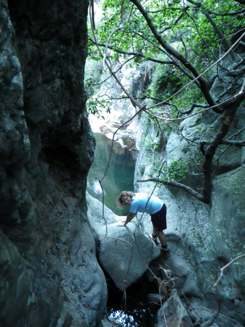
The water was freezing, so we quickly swam to the far side and explored further down the canyon. It wasn’t long before we came to a second drop, this one much larger with a few old slings at the top hinting that we were not the first ones down here. Our lack of proper canyoning gear forced us to turn back, but this canyon could definitely be worth a return trip. We scrambled back up and rejoined the others, and headed back to the lunch spot to pick up our packs. The climb from here up to the plateau was steep but uneventful other than a strange fence line half way up that seemed very out of place. We made it to the top to find a cozy campsite right on the edge of the plateau, and settled in for an evening of discussing strange Czech Easter traditions (mostly involving whipping young women).
Day 3
We packed up after an early breakfast and made our way across the plateau toward Yulludunida Crater. The walking was easy with great views, until we came to the end of the plateau and found our way blocked by cliffs. Several different routes were considered – all dangerously scrambly – before we finally backtracked until we found a slightly less dangerous down climb on the northern side of the plateau.


We skirted back around to the ridge line over some steep and slippery slopes, and then bashed on through the scrub. The going was difficult in places, but still interesting, as we got occasional glimpses down into the valleys to the north and south, as well as occasionally tripping on the strange fence that crossed our path at frequent intervals (you would think they would have built it along the ridge top, but apparently zig-zagging back and fourth was more fun!).
We hit the main track to Yulludunida in time for an early lunch, and hid our packs in the scrub before heading up to explore the crater. We followed the track only as far as the base of the crater wall, and then found our own route to the top via a steep scramble.

Here we once more came across the fence line, this time running straight up and over the sheer walls of the crater. I can’t help but think that the surveyors must have been playing a cruel joke on the fencing contractors.

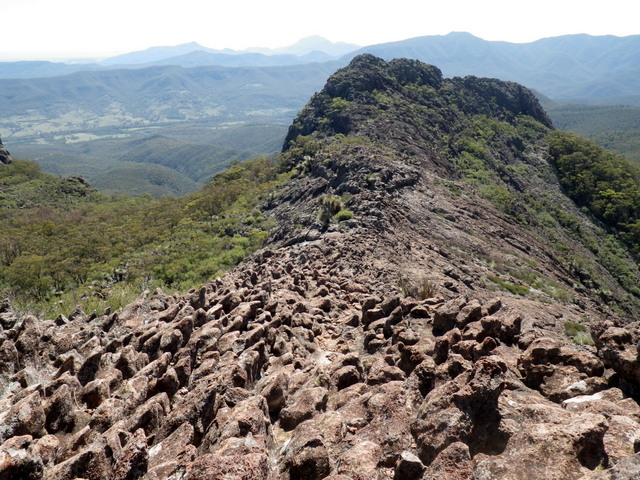
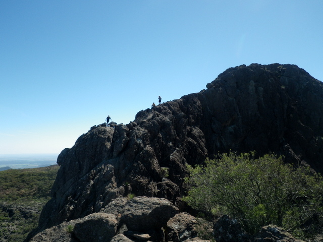
From here we began our traverse of the crater wall, scrambling up and down the peaks along the rocky ridge. The going was easier than expected, again due to the strange dragon-scale rock formations providing plenty of hand holds on the steep sections. The views were fantastic, and we were sad to come to the end of the wall and have to climb down and return to our packs.
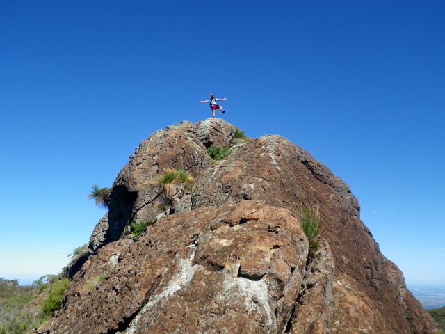


With heavy hearts (and packs), we said goodbye to the beautiful crater and recovered our packs on our way down the mountain. Remembering that T2’s car was almost out of fuel, Tom and I decided to run ahead and try to hitch-hike back up to the car we left at the top, rather than using T2’s car. Luckily, there was an elderly couple parked at the bottom who were happy to drive a smelly bushwalker up to the top, and in short order we were cramming ourselves into the cars for the drive home. T2 had his fingers crossed that he would make it to Narrabri, and that the petrol station would be open. Fortunately we did not have to leave him behind. We continued on for a pub dinner in Mudgee, before finally returning exhausted to our various homes.
Thanks to all for a great trip in a beautiful new area. It definitely deserves to be revisited!

Great views, great shots, magnificent country. Thanks for your work.